
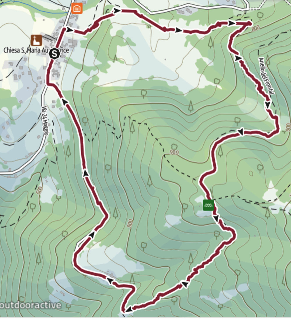
- Distance and Time required: 5 | 2h
- Elevation gain: 265
- Difficulty: Media
- Starting Point: Parking in Piazza dei Tigli in Milies
- Short description: A mountain loop filled with the scent of the forest, winding through shaded trails, meadows, scenic views, and old country houses. Following a well-marked path, we’ll reach Posa delle Cirulette (950 m), and from there begin our descent toward Cerula, enjoying beautiful views over the Piave Valley and Mount Grappa along the way.
- Stroller/Wheelchair accessible: No
The Walk
This Sunday the family's a bit under the weather with seasonal bugs, so it’s just me and Sebastian heading out for a good stretch of our legs in Milies along the Anello delle Cirulette (Cirulette Loop). For Sebastian, it’s also his very first hike with a backpack on. The walk is deep in a lively forest and it’s really pleasant and fresh — don’t forget your hiking boots!
Our starting point is Piazza dei Tigli in Milies. From here, we walk about 100 meters north (towards the fountain) along Via dei Narcisi. On the wall of a house, Sebastian spots a photo that at first looks like a bear; he stops to get a better look and realizes it’s a man carrying a big bundle of firewood.
On the right, between the houses, there’s a gravel track and a sign marking the start of the Anello delle Cirulette. We’re immediately surrounded by thick woodland: hanging from the tree branches are some small wooden decorations, and under our feet we’re walking on what used to be a Roman road connecting Stramare to Monte Doch.
 Panel of the Anello delle Cirulette
 Roman road
We come out into a sunny clearing, but soon we’re back in the woods. Beside the trail, someone has built a little tent out of logs. Today, my walking buddy is very curious about all the flowers in the fields and keeps asking me questions... unfortunately I don’t know many replies. If mum were here, she’d be much better at this than me.
More meadows, and then we’re back among hornbeams, beeches, and other woodland trees. On the ground, we notice horse tracks. A bit further along, on the right, there are two wooden benches and the son of the “Fagheron”: a massive mountain maple with lush green leaves that seems to reach for the sky.
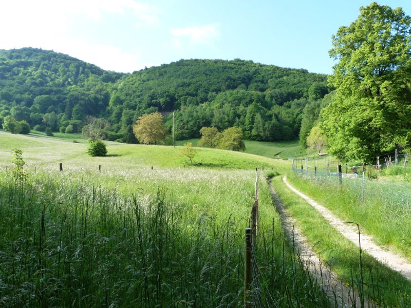 Landscape
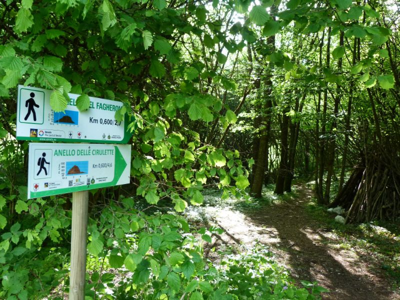 We follow the signals
We reach a fork where we keep right (left takes you to the Fagheron Loop), and the climb begins — at times a bit steep. Around us, constant birdsong, green canopies, nettles, blue and violet flowers, and lots of ferns.
Speaking of ferns, Sebastian tells me they were a triceratops’ favorite food. I stop for a second and say, “But in the end, the triceratops went extinct... and the fern is still here.” Sometimes in nature, it’s not the biggest or the strongest who survive, but the ones who adapt and stay in balance with their surroundings.
 Orchis flower
 Posa delle Cirulette
We reach a mule track and with it the end of the toughest climb. We continue to the right up to Posa delle Cirulette (950 m), the highest point of this walk. Nearby, there’s a viewpoint we couldn’t manage to find.
 To Cenola
 Panoramic View
From here, we calmly head downhill to the right (there’s a sign), following the directions for Cenola Milies, along a descent with a good bit of slope to it.
We pass near a rustic house, and the view opens up to an incredible panorama of Mount Grappa — its summit covered by clouds — the Piave Valley, and the Asolo Hills. We stop here for a while to take it all in and make peace with having missed the previous lookout point.
When we reach the gravel road, we turn right and walk among the houses until we’re back in town. But before getting back in the car, we make a necessary stop: at Osteria Romolet.
 Walking to Milies
 Osteria da Romolet
Anita and Stefano always welcome us with a smile and a tasty platter of cold cuts, a beer, and a Coke (I probably don’t need to tell you who gets what). Outside, there’s a little playground and in summer a kiosk with beer, pizza slices, and sandwiches — perfect for anyone like us who loves to end a hike with some fun and chill time.
Photo Gallery
Eat and Drink near the walk

Osteria da Romolet
Cold cuts, tagliatelle, gnocchi, grilled meat and spiedo
in Milies in via dei Ciclamini n. 4
Tel. 0423 979400
Track Gps
What to see
Posa delle Cirulette
Panoramic View on Monte Grappa e Valle del Piave
Eat and Drink near the walk
Osteria da Romolet
Cold cuts, tagliatelle, gnocchi, grilled meat and spiedo
in Milies in via dei Ciclamini n. 4
Tel. 0423 979400
Refreshment Points
Osteria Romolet - Via dei Ciclamini n. 4 a Milies - Tel. 0423 979400
Fontana in centro a Milies
Curiosities
The Posa delle Cirulette stays full of water all year round because it’s fed by a natural spring.